Equipment & Software for Geophysical Surveys: Design, Manufacture, Support, Supply
ZondRes2D — 2.5D electrotomography for resistivity and IP
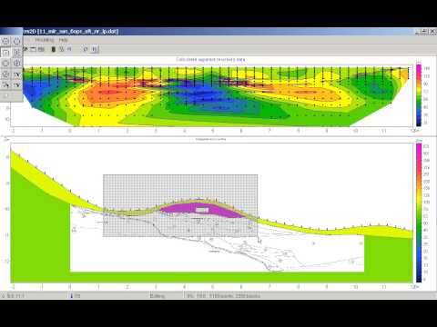
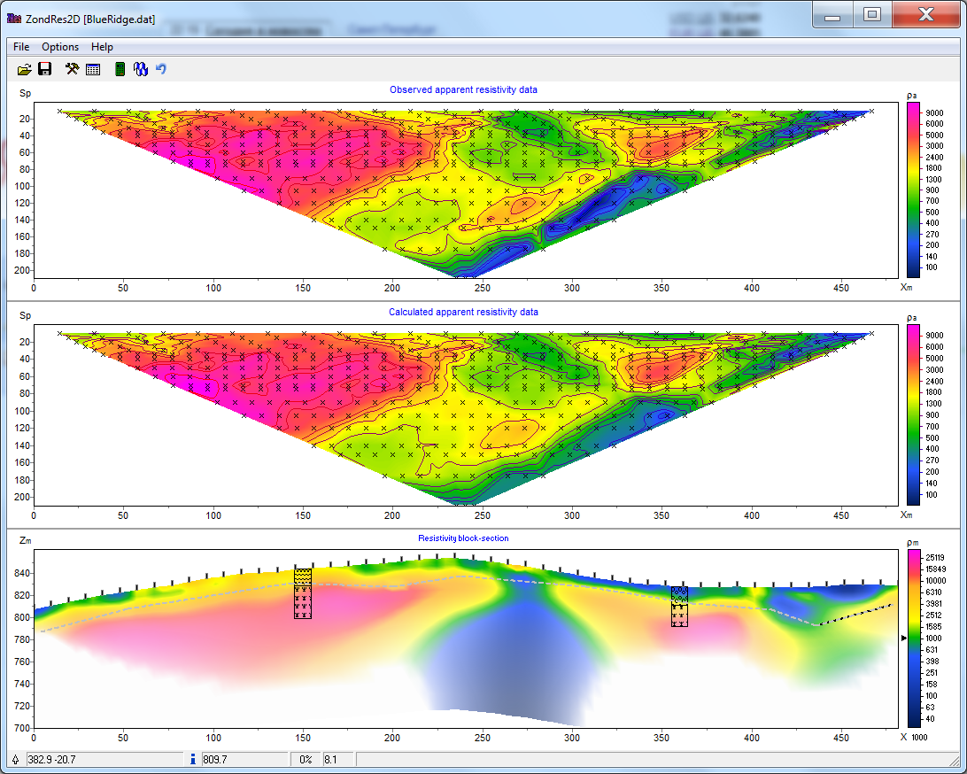
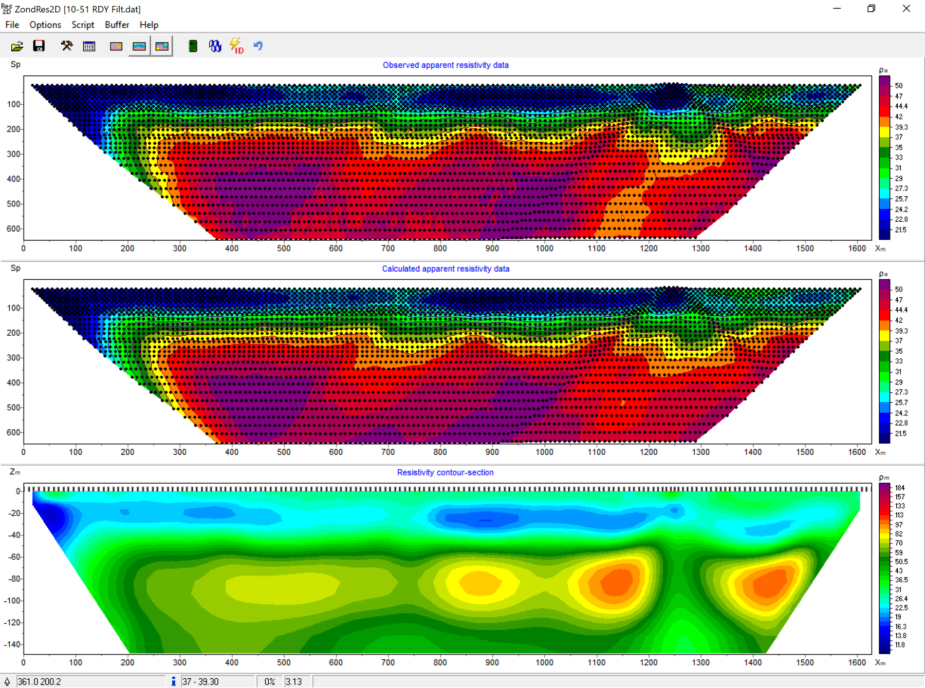
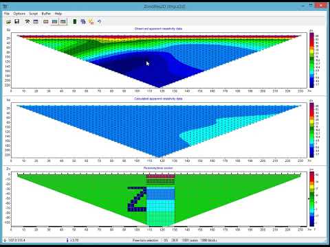
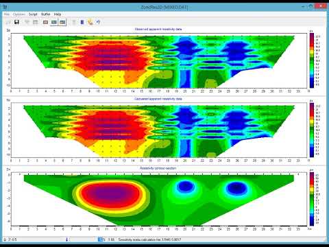
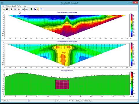
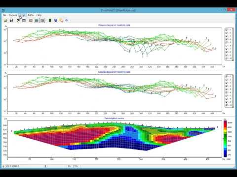
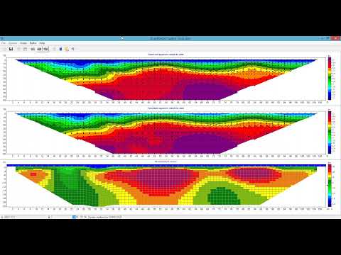
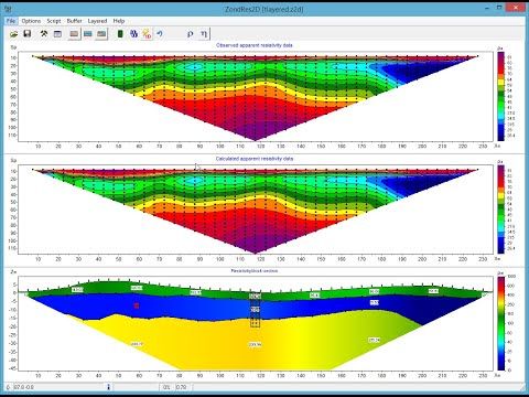
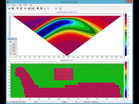
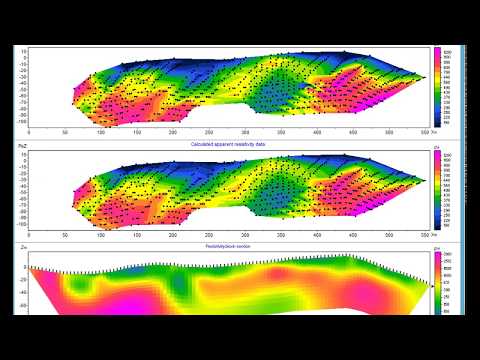
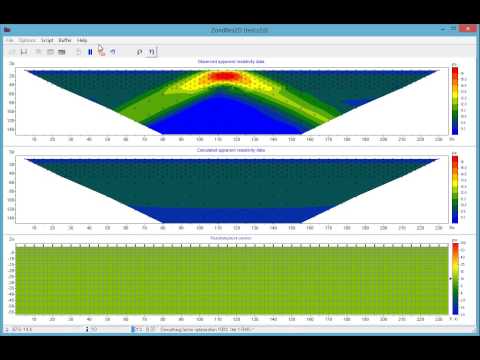
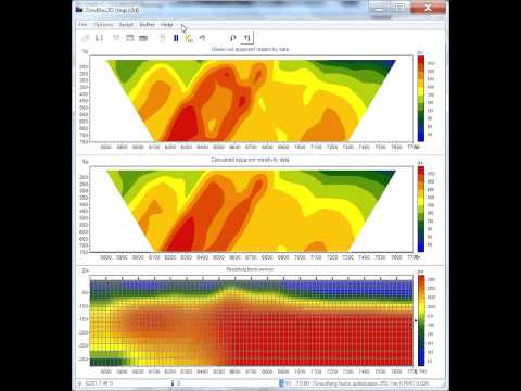
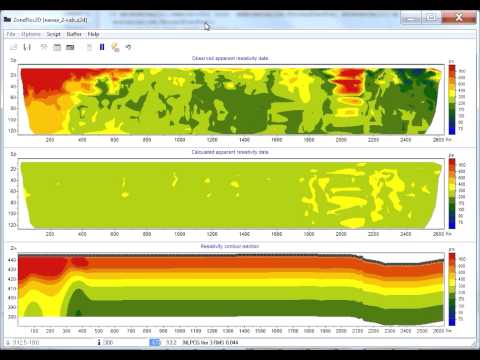
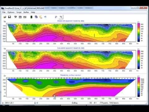
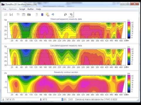
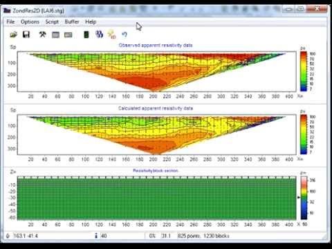
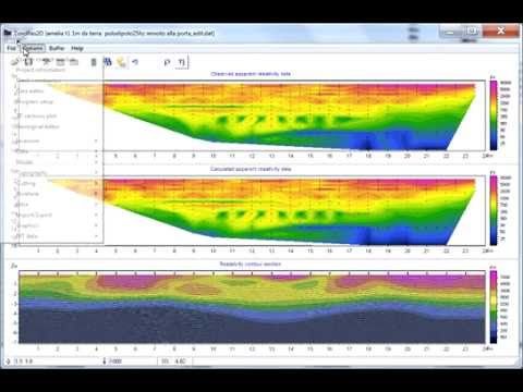
ZondRes2d software is designed for 2D interpretation of electrical tomography data by resistivity and induced polarization (IP) methods during land, borehole, and offshore surveys.
ZondRes2d solves a wide variety of tasks from mathematical modeling, observation system selection, data quality and sensitivity analysis, to field data processing, inversion, and interpretation.
A user-friendly interface and a wide range of data presentation options make it possible to solve the set geological problem in the most efficient way.
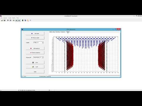
Creation of measurement protocols:The program allows to create measurement protocols for the following arrays of electrodes: 2-electrode (Pole-Pole,A-M), 3-electrode (Pole-Dipole, A-MN), dipole (Dipole-Dipole, AB-MN), Wenner (A-M-N-B), Schlumberger (A-MN-B), and Gradient (A-MN-B). Measurement configuration can be saved in Syscal sequence [*.txt], ABEM sequence [*.xml], MAE sequence [*.sem], AGI sequence [*.cmd], and MAE instrument [*.sem] formats. Besides, the program implements an algorithm for creating a protocol for cross-hole observations, taking into account the verification of unstable values that are sensitive to errors in the electrode geometry.
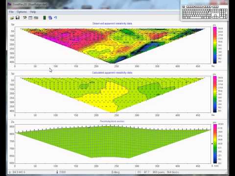
Supported data types:- Any type of survey arrays and measurement configurations, arbitrary spacing of electrodes, including vertical electrical sounding (VES)
- Positions of electrodes: ground surface, borehole, borehole- borehole, ground surface-borehole, surface of the water area, in the water column, bottom of the water area, ground surface-water area
- Straight and nonstraight profile lines
- Coordinates along the profile lines, rectangular, geographic, and X,Y,Z coordinates
- Vertical and inclined boreholes
- Data obtained during galvanic grounding of electrodes and non-contact sounding data
- Stationary data and data obtained in motion, monitoring
- Input data for calculating the resistance model: apparent resistance, signal-to-current ratio
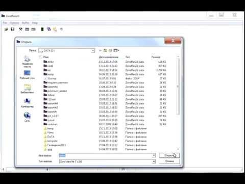
- Supported formats: Zond data file[*.z2d], ProfileR data file [*.in], ABEM / AGI / SYSCAL text file, Res2dInv [*.dat], ARES Sens2dInv [*.gem, *.imp, *.sen], Zond1d file convertion [*.zlf], Omega-48 data files, Skala-48/64 csv files, SmartTEM-24 file [*.ip], GDD instruments [*.gdd], MAE instruments [*.tsv], GeoSoft data [*.dat], Zonge data, LGM device, arbitrary files of text file or Excel spreadsheet
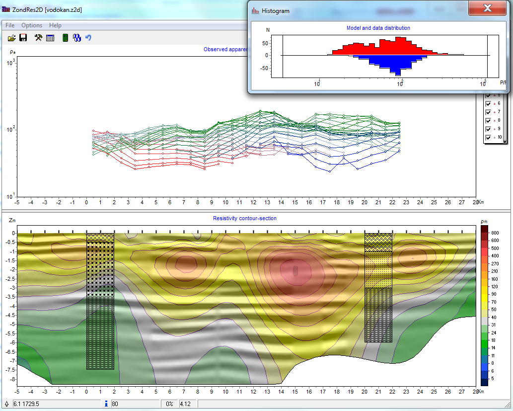
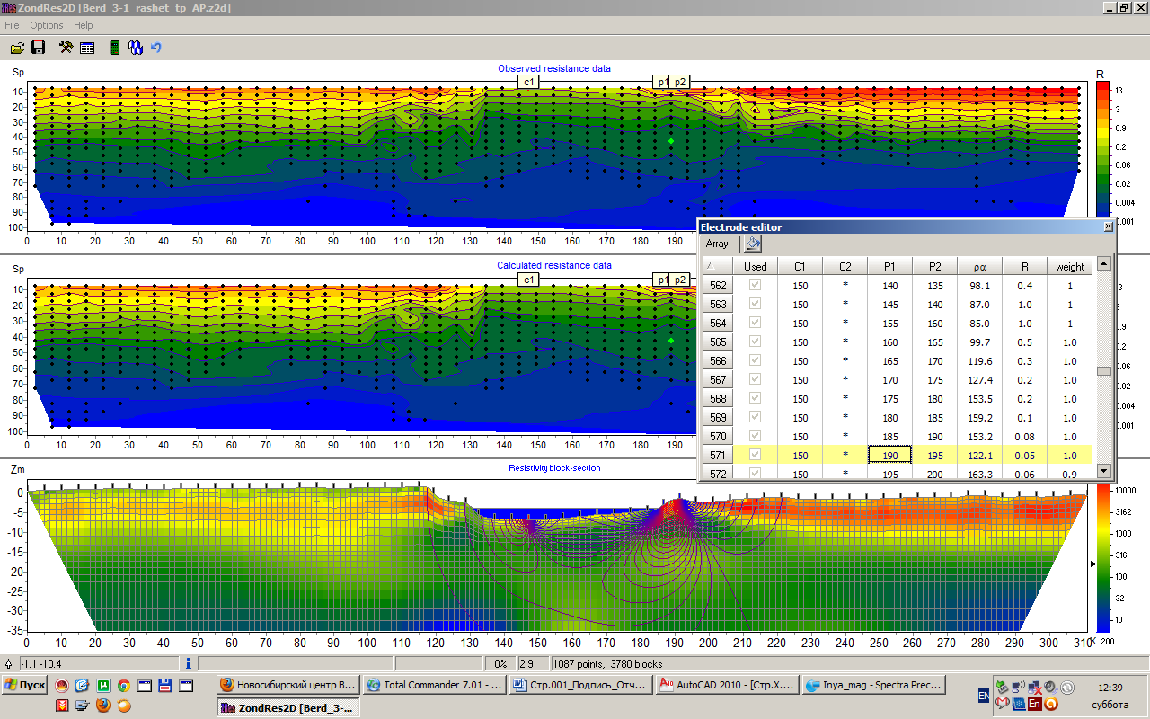
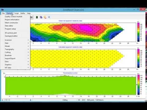
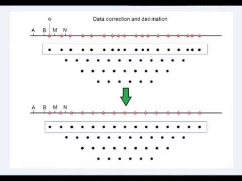
Preparing data for inversion includes the following set of actions: assessing the quality of field data, removing poor quality measurements, assigning weights to measurements depending on their quality, combining several arrays into one profile line, filtering data, entering and correcting topographic data. Besides, the program can recalculate the data of opposite three-electrode arrays into a four-electrode AMNB or an anomalous symmetrical AMNA array.
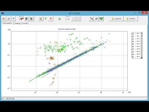
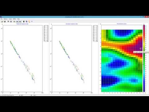
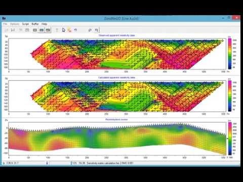
The electrical tomography data quality control module allows you to quickly and efficiently identify problematic measurements in automatic and semi-automatic modes.
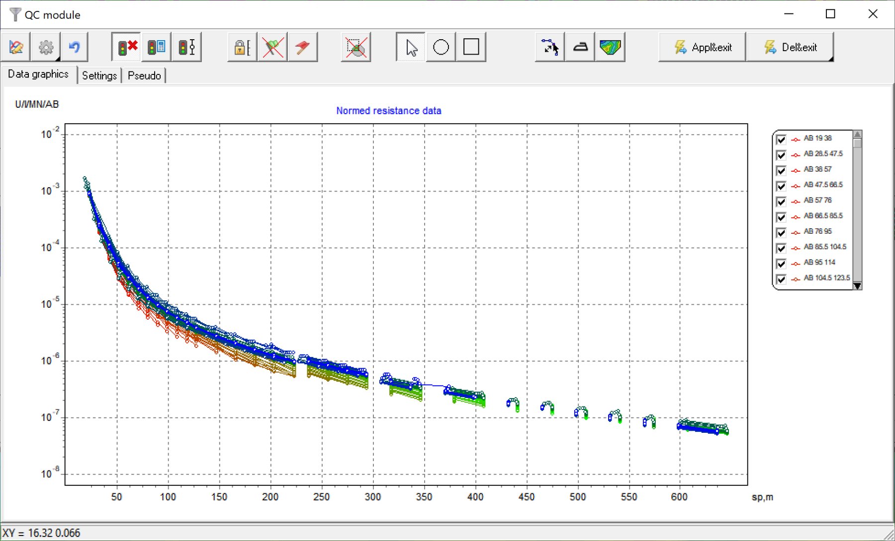
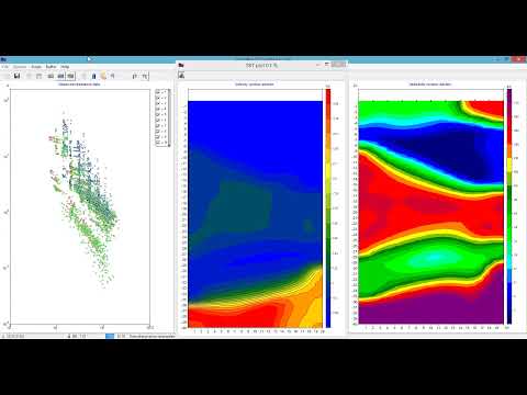
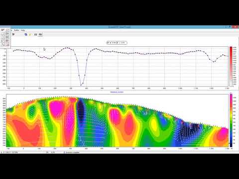
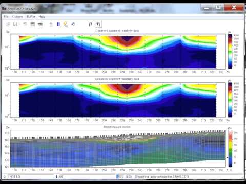
- Visualization of measurement results in the form of graphs of various parameters and in the form of pseudosections of data from different arrays
- Grouping data by arrays, signal, various geometric parameters, and measurement weights
- Evaluation of data quality based on the reciprocity principle
- Automatic deletion of data with high discrepancy values obtained as a result of inversion
- Manual deletion of data directly in charts
ZondRes2d has a large set of tools for mathematical modelling and analysis of sensitivity of the direct current and induced polarization fields which allows to evaluate the level of signal and choose the optimal parameters of the observation system in order to solve the geological problem.
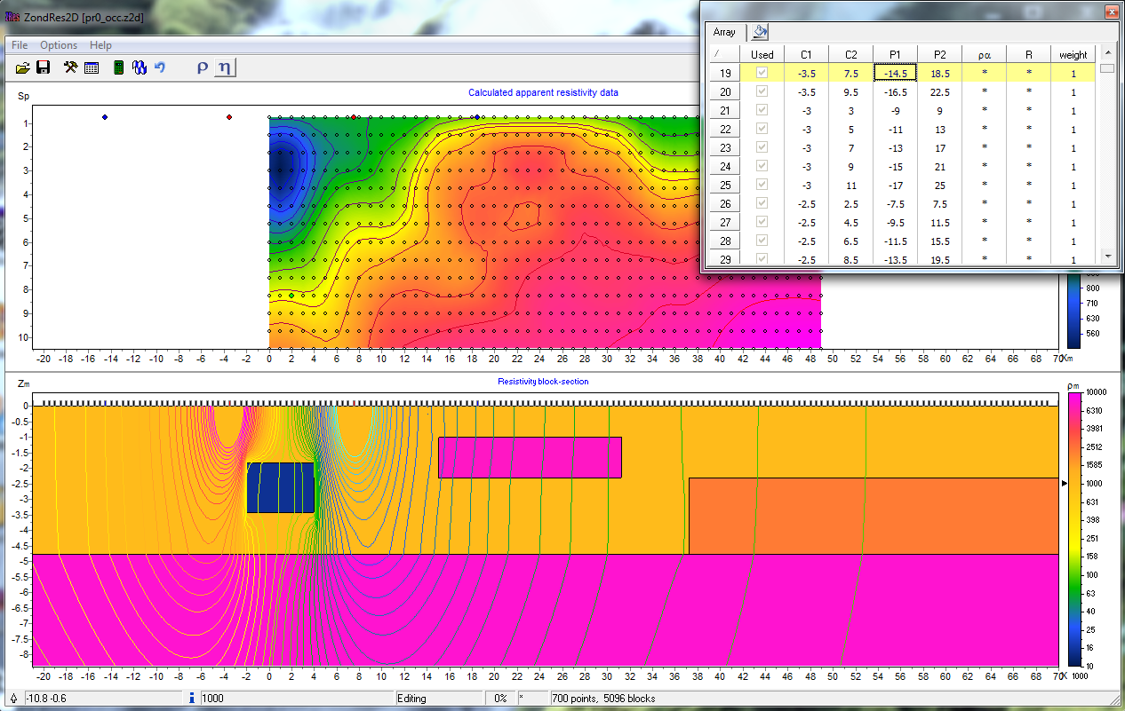
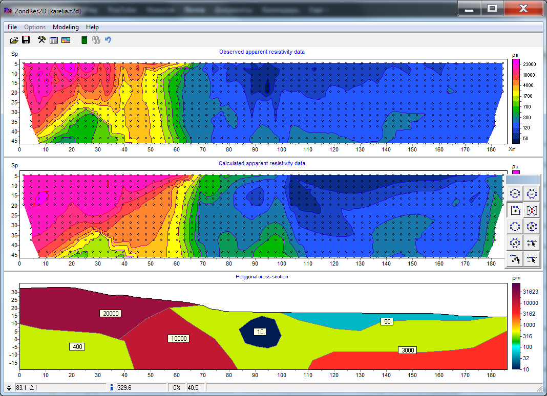
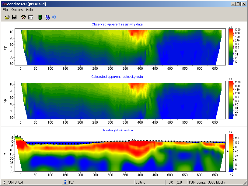
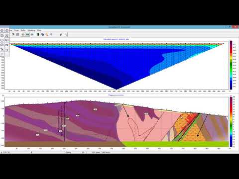
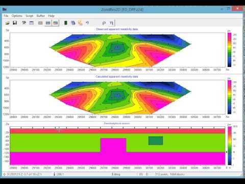
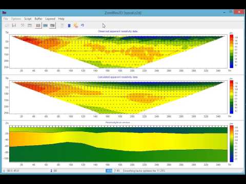
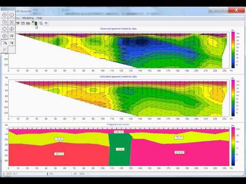
Mathematical modelling and data inversion:- Inversion options: smooth, focusing, robust, block, cross-gradient, Gauss-Newton, using L0, L1 and L2 norms, customizable parameters for normalization, regularization, smoothing, and resolution
- Modes of building a model when solving direct and inverse problems: grid, block, polygonal, arbitrarily layered model
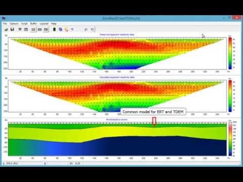
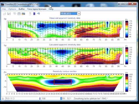
- Inversion of geoelectric monitoring data
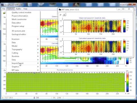
- Joint inversion with magnetotelluric data
- Joint inversion with data of near-field time-domain electromagnetic sounding and frequency sounding
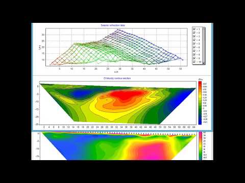
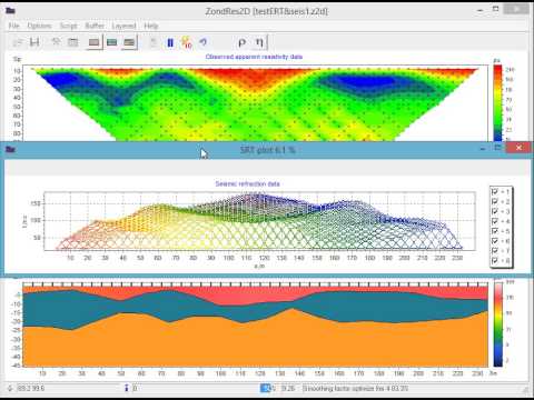
- Joint inversion with refracted seismic data
- Inversion of gravimetric and magnetic measurements data, including joint with ERT data
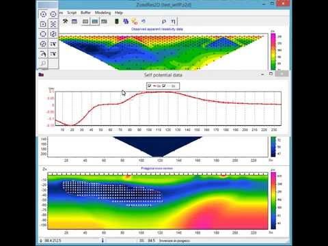
- Advanced polygonal modelling for magnetic survey, gravity survey and self-potential (SP) method
- Suppression of P/C static shifts during inversion
- Working with anomalous arrays (method of true anomalies)
- Supporting magnetometric resistivity (MMR) method
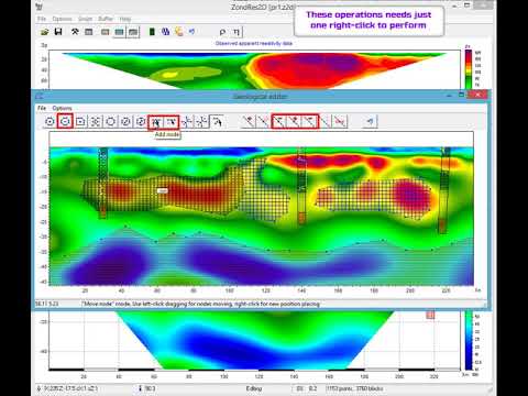
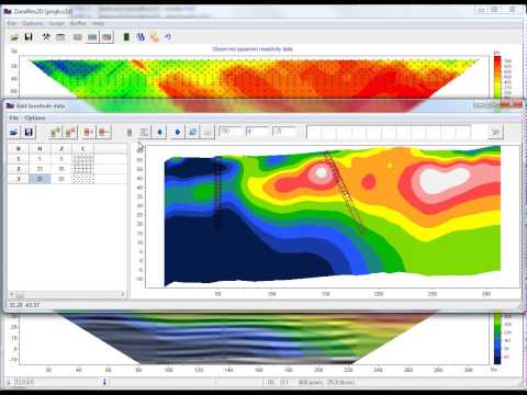
- Placement of lithological columns on the model
- Visualization of logging data
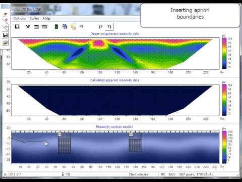
- Implementation of a priori boundaries
- Placement of the background for the start model in the BMP, PNG, SGY, or SEC formats
- Setting the start model parameters
- Fixing the limits of parameters variation
-
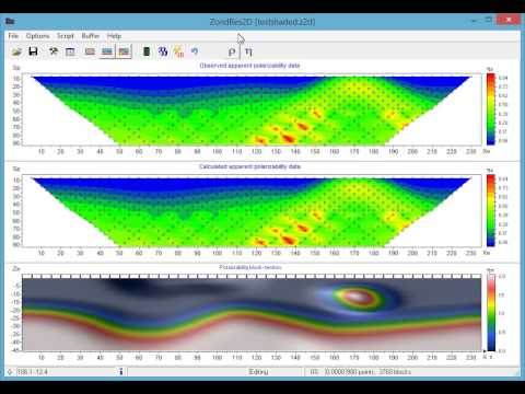
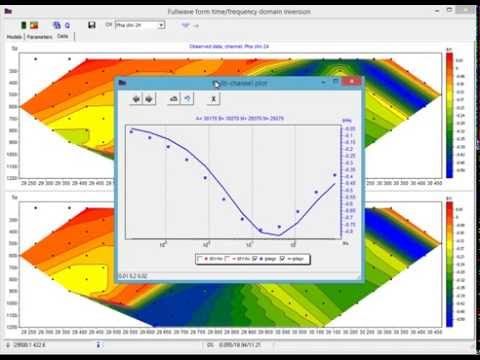
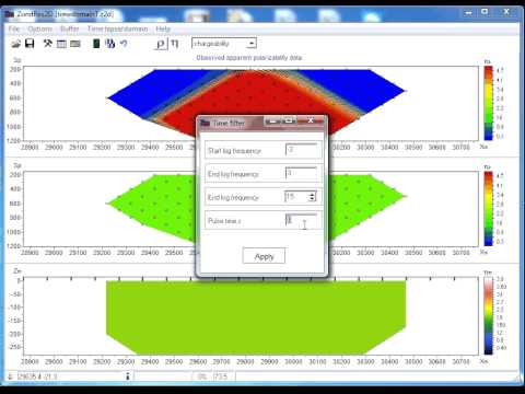
The program implements the functional which allows the user to work with the data of induced polarization (IP) measured both in the frequency and time domains.
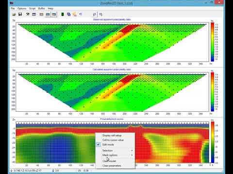
- Input data for the calculation of the chargeability model: apparent chargeability, apparent polarizability, polarizability drop-down curve, module of the measured signal normalized to the current, phase, shift of the phase between the first and third harmonics
- Inversion of chargeability and full waveform inversion of drop-down curve with the Cole-Cole model parameters recovery
- Passage from the frequency domain to the time domain by applying a Fourier transform with indication of the pulse length
- Method of Born with reconstruction of independent model of the polarizability at each time pause
- Model interpretation module (shading with polygons)
- Export of DAT file [*.dat], grid file[*.grd], isolines map [*.srf], blanking polygons [*.bln] and color scale [*.lvl] of the Surfer program
- Export of a model in the vector form to a [*.dxf] file of the Autocad program
- Saving the model and interpretation results as a raster image with preset scale, resolution and font size
- Exporting the model to the Oasis Montaj program format
- Saving the model in SEG-Y format
- Saving the model to a file [*.xls]
- Saving the work area to [*.bmp] or [*.pdf] files
- Converting electrotomographic data into VES data in order to select a geoelectric model in the 1D version in the ZondIP1D program
- Converting a set of 2D files into one file in order to select a 3D geoelectric model in the Zondres3d program
- Working with several models in one project
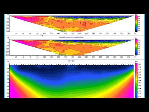
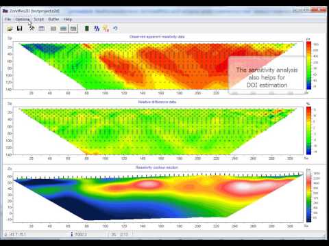
- Assessment of the solution quality based on the sensitivity matrix. Calculation of the quality parameter of the obtained solution, DOI index
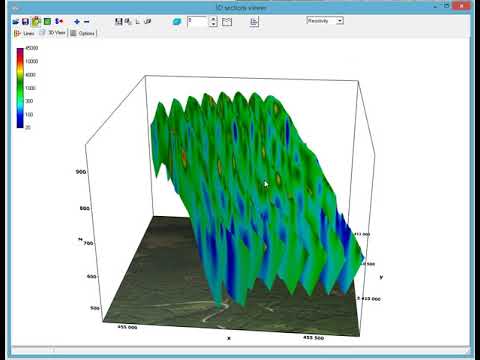
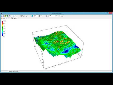
- 3D visualization of geoelectric sections using an arbitrary system of profile lines. Depth-slice maps of various parameters
- Setting the angle of strike of the ore body in relation to the profile line
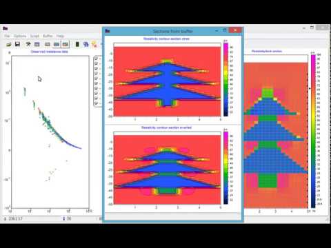
- Saving up to 5 models in the buffer for further comparison
- Recording of a script for treatment of several files
- Extracting self-potential data from electric tomography data
There are several configurations of the ERT data processing software ZondRes2D .
ZondRes2D Standard – full-featured configuration of the program for processing ERT and IP data in land, borehole, and marine variants. In this configuration, options for joint inversion with data obtained by other methods, full-wave inversion of IP data, and inversion of geoelectrical monitoring data are available.
ZondRes2D Light - configuration intended only for resistivity data processing, all features are available.
Features of ZondRes2D program, that differ depending on the configuration:
| Standard | Light | |
| Modes of building a model when solving direct and inverse problems | mesh, block, polygonal, arbitrarily layered model | mesh, block |
| Inversion of IP data, both according to the standard scheme, and in the time or frequency domain with the Cole-Cole parameters recovery | + | - |
| Full-wave inversion of IP parameters | + | - |
| Inversion of geoelectric monitoring data | + | - |
| Joint inversion with magnetotelluric data | + | - |
| Joint inversion with TEM and FS data | + | - |
| Joint inversion with refracted seismic data | + | - |
| Inversion of gravimetric and magnetic measurements data, including joint with ERT data | + | - |
| Advanced polygonal modelling for magnetic, gravity and SP method (EP) | + | - |
ZondRes2D belongs to the Zond programs family. A unified interface and approach to data processing make it easy to familiarize yourself with operation of the entire package – in case you have the skills and experience of working with one of the programs. This approach allows interpreters to instrumentally integrate various geophysical data, which leads to a more stable and reliable geological and geophysical model.
Zond software family:| ZondIP1d | Designed for 1D inversion of VES and VES-IP data. |
| ZondRes3d | Designed for 3D inversion of resistivity and induced polarization data in land, borehole and marine variants. |
| ZondProtocol | Designed for creation of protocols, measurement control and visualization of ERT measurements and data quality assessment. |
| ZondMT1D | Designed for 1D inversion of magnetotelluric (MT), audiomagnetotelluric (AMT) and radiomagnetotelluric (RMT) data. |
| ZondMT2D | Designed for 2D inversion of MT, AMT and RMT data. |
| ZondGM2d | Designed for 2D multiprofile inversion of gravity and magnetic data. |
| ZondGM3d | Designed for 3D inversion of gravity and magnetic data. |
| ZondTEM1d | Designed for 1D inversion of transient electromagnetic (TEM) data for various observation systems with lines and loops. |
| ZondTEM2d | Designed for 2D inversion of EM soundings data in time and frequency domain. |
| ZondSP2d | Desined for 2D inversion of self-potential data. |
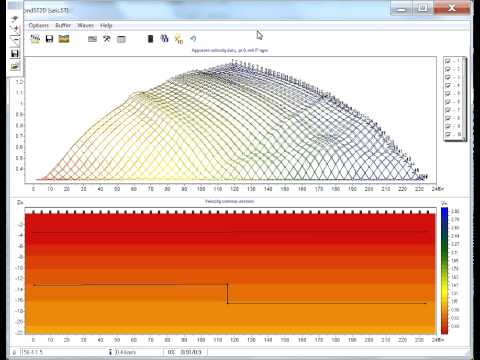
| ZondST2d | Designed for 2D inversion of seismic tomography data (first breaks) and refraction seismic. |
| ZondST3d | Designed for 3D inversion of seismic tomography data (first breaks) and refraction seismic. |
| ZCGViewer | Designed for calculation and visualization of apparent resistivity graphs obtained with various electric survey systems. |
The software can be installed on a computer with OS Windows 98 or later. Calculations in a 64-bit version are available for large datasets.
You can learn more about the features of the software by downloading the user manual or demo-version of the program, or by watching video lessons.
Other
Review of some importing possibility of Zond 2D softwares (16.01.2022)
Inversion of all res2dinv examples in one video (15.01.2022)
Basic topography options in ZondRes2D (14.01.2022)
Pre and Post filtering of ERT data in ZondRes2D (14.01.2022)
Batch processing of data files in ZondRes2d software (16.12.2021)
Arbitrary-layered 2D model in Zond products (14.12.2021)
Modelling and meshing options of Zond 2D products (13.12.2021)
Geological editor in Zond software products (8.12.2021)
3D fence diagram review (2.12.2021)
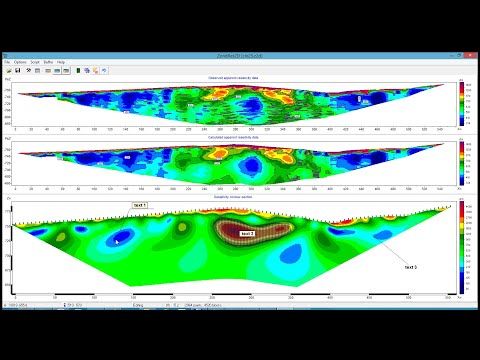
Incorporating of additional elements into interpretation results (24.11.2021)
Joint inversion of cross-borehole ERT and seismic tomography data (05.08.2021)
Another tool for postfiltering ERT data in ZondRes2D (18.07.2021)
Zondres2D new functions review (27.05.2021)

Self-potential data importing from ERT dataset (IRIS R10 instruments) (06.09.2020)
Polygonal modeling based on geological section in ZondRes2D (27.05.2020)
Cross-boreholes sequencer in ZondRes2d (24.05.2020)
How to suppress borehole's distortion effect in crosshole ERT data (18.05.2020)
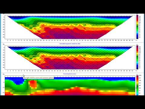
Image-guided inversion (29.04.2020)
Direct drawing XY slices into Surfer (18.04.2020)
Work with pseudosections in ZondRes2D (29.06.2019)
Inverted model analysis in ZondRes2D (25.06.2019)
Cross-hole resistivity imaging (17.06.2019)
ZondRes2D new inversion approach (05.04.2019)
Joint inversion of ERT and seismic tomography manual (16.10.2018)
Quick ERT data denoising (03.03.2018)
Using topography in ZondRes2D (14.09.2016)
Combined inversion of ERT and self-potential data for enviromental (17.06.2016)
OhmMapper | BIKS data inversion in ZondRes2D (18.11.2015)
Creating shaded image in ZondRes2D (6.05.2015)
Modeling&Inversion for test model (research problem) (26.04.2015)
Comparision of phases and differential phase parameter(ISIP) in 2.5D SIP modeling (24.04.2015)
ERT2.5D&TDEM1D joint inversion (21.04.2015)
Full 2D joint inversion of resistivity imaging and refraction seismic data (6.04.2015)
Estimation of DOI in resistivity imaging (27.03.2015)
Using of boreholes data in zondres2d (22.02.2015)
Inversion for arbitrary layered model in ZondRes2D (22.02.2015)
ZondRes2D. Last update features. (24.10.2014)
Importing of Excel data to ZondRes2D (13.10.2014)
Resistivity inversion of long profiles in ZondRes2d (22.06.2014)
Joint interpretation ERT and refraction seismic data (10.06.2014)
Smoothed isolines mode in ZondRes2D (29.05.2014)
Electromagnetic coupling in ERT data: removal (26.05.2014)
Packet processing of data files in ZondRes2d (23.05.2014)
ERT inversion with GPR background (19.04.2014)
2d resistivity inversion with apriori constraint (20.03.2014)
Using of strike in 2D electrial resistivity tomography (17.03.2014)
2D inversion VES data in ZondRes2D (15.11.2013)
2D Joint inversion of electrical resistivity tomography and radio magnetotellurics data (7.11.2013)
Resistivity imaging for monitoring of storage conditions (16.07.2013)
Full wave form time domain and frequency domain induced polarization inversion (25.06.2013)
Advanced interpretation of ERT and magnetic data (24.06.2013)
ProfileR_ZondRes2D (28.03.2013)
Resistivity imaging (ERT) with ZondRes2D (9.03.2013)