International - English
Canada - English
Canada - French
France - French
France - English
Mexico - Spanish
USA - English
Казахстан - Русский
Қазақстан - Қазақша
Узбекистан - Русский
Cart:
0
Shipping and payment
Search
office@geodevice.ca
office@geodevice.fr
+1 587 288-13-30
+33 42 257-00-01
Equipment & Software for Geophysical Surveys: Design, Manufacture, Support, Supply
Order a call
Ask a question
Menu
EQUIPMENT
Land Seismic
Sigma4+
DAQlink 5
SUMMIT X One
LandStreamer
SUMMIT M Vipa
ALL-in One
Time Stamp Recorder - TSR 4
Wireless Trigger Box4
Time Sync Unit - TSU1
RadExPro
ZondST2d
ZondST3d
GeoTechControl
Accelerated weight drop
Seismic pulse source
Borehole Seismic
Marine seismic
Energy sources MultiJack
Electrodynamic sources G-Boomer
Freshwater Sparkers
Marine Sparkers
Deep Water Sparkers
HRStreamer
Multichannel marine towed HRStreamer-24/48
BHStreamer − Bottom hydrophone streamer
Light winch DR
Towed and deck HV cables
Sigma-4 and DAQLink4 seismographs
Deck winch DW
RadExPro Marine
Front and tail buoys
Multi-band GNSS receivers
Single channel setup
Portable single channel setup
Setup for unmanned operations
Advanced multichannel setup
Oceanography studies setup
UHRS data processing
Borehole seismic
Sigma4+
Energy sources Jack
DAQlink 5
Pulse
SHock
GeoSV
ALL-in One
Rod feeder
Hydrophone array
Geophone array
GStreamer-E
GStreamer-P
INCLIS
BGW borehole winch
BGW light
RadExPro
ZondST2d
ZondST3d
Sources for VSP
Land, Drone & Airborne Magnetic
MaxiMag and AeroSmartMag
QuantumMag and AeroQuantumMag
MaxiMag and SmartMag
Overhauser AeroSmartMag
Cesium AeroQuantumMag
Cesium CSMx
Overhauser walking MaxiMag
Cesium walking QuantumMag
Overhauser base SmartMag
Cesium base SmartQuantumMag
MagCart for multi-sensor gradiometer
True Terrain Following
UgCS
PIMV
SmartManager
ZondGM2d
ZondGM3d
Horin
Marine Magnetic
MariMag LG
MariMag HTG
MariMag
Cable Counter
ZondGM2d
ZondGM3d
Magnetic Susceptibility
PIMV
Geoelectrical & electromagnetic
ALMAZ Marine
ZondIP1d
ZondSP2d
ZondRes2d
ZondProtocol
ZondRes3d
ZondMT1d
ZondMT2d
ZondTEM1d
ZondTEM2d
ZCGViewer
Cable systems and accessories
Cable reels
Electrodes
Gamma radiation detection
Field SRP-20
Borehole SRP-20
Rod feeder
Winches and reels
RТ-1
RT-1S
RТ-3S
RT-4S
RT-5S
Light winch DR
BGW borehole winch
BGW light
Deck winch DW
SOFTWARE
Seismic
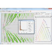
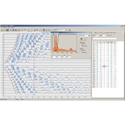
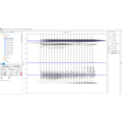
RadExPro
ZondST2d
ZondST3d
GeoTechControl
Geoelectrical & electromagnetic
ZondIP1d
ZondSP2d
ZondRes2d
ZondProtocol
ZondRes3d
ZondMT1d
ZondMT2d
ZondTEM1d
ZondTEM2d
ZCGViewer
Magnetic
UgCS
SmartManager
ZondGM2d
ZondGM3d
Horin
Services
Geophysical surveys
Data QC and processing
Consulting
Extensive training
Field works startup and supervising
Technical support
FAQ
About
About
Calendar
Photos
News
Contacts
Contacts
SOFTWARE
EQUIPMENT
SOFTWARE
/
Seismic
Seismic
Geoelectrical & electromagnetic
Magnetic
Seismic
RadExPro
ZondST2d
ZondST3d
GeoTechControl